01 — Question
Where rivers go.
Predicting the path of an avulsing river before it moves. The geometric signatures in floodplain topography that encode avulsion risk — and how they change downstream.
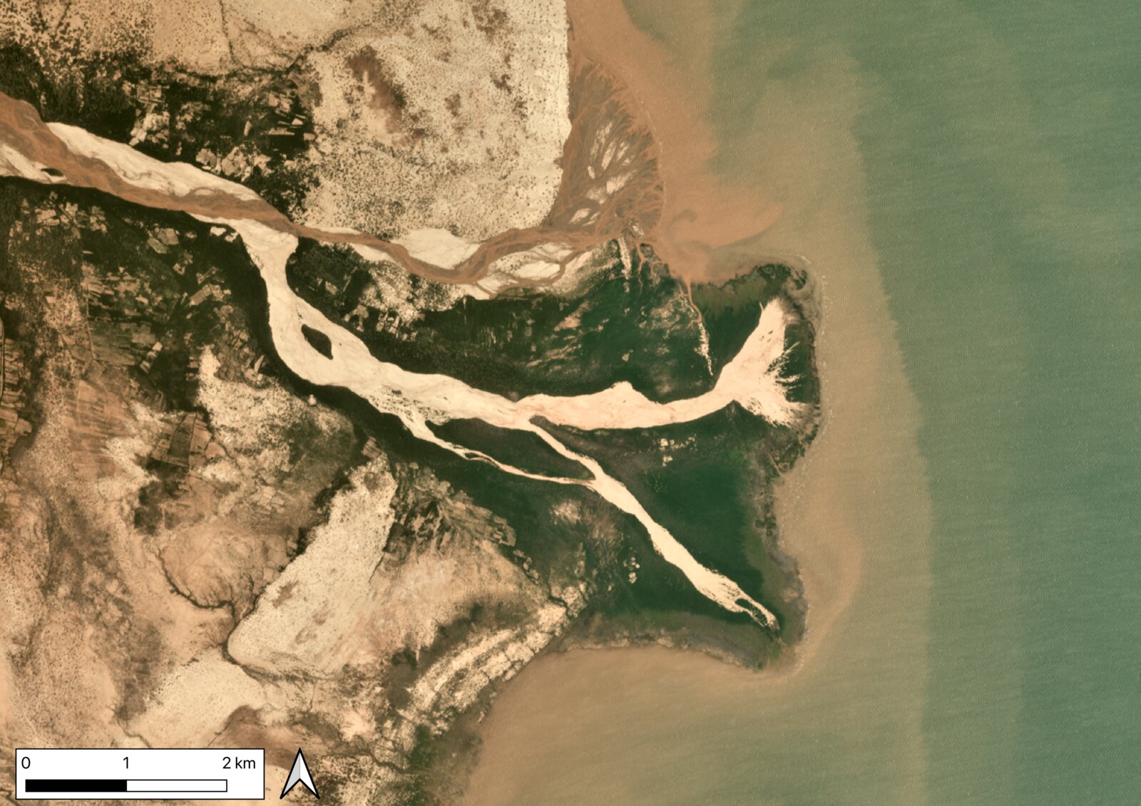
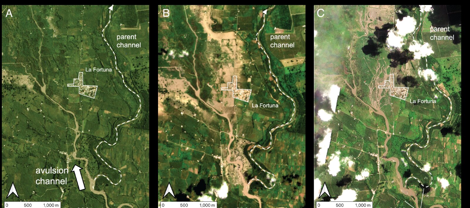
Rules of river avulsion change downstream
A framework for predicting where rivers leave their channels. The geometry that controls avulsion shifts predictably along a river — and the rules differ between fans, alluvial plains, and deltas. Built from 174 post-1984 avulsions, mapped from satellite imagery and SRTM topography.
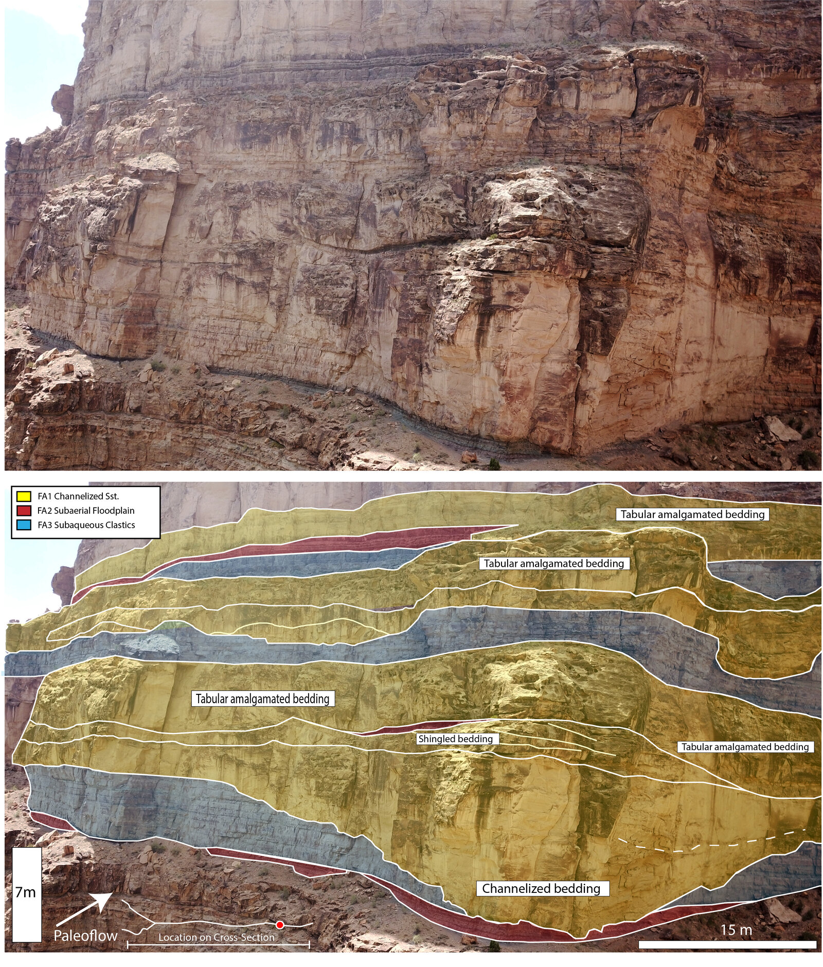
Avulsion precursors encoded in alluvial ridge geometry
A follow-on. The shape of the alluvial ridge around a channel records imminent avulsion risk before the channel breaks. A topographic precursor signal you can read from a DEM.